
About This Park
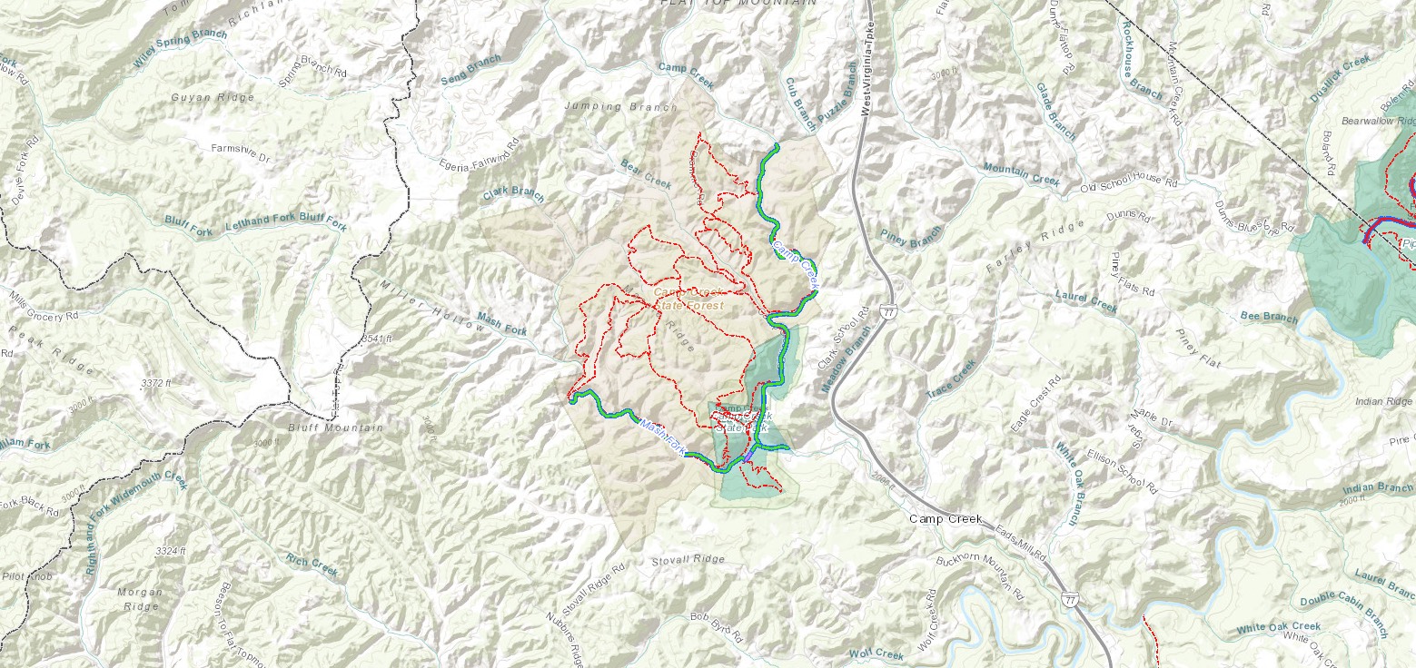
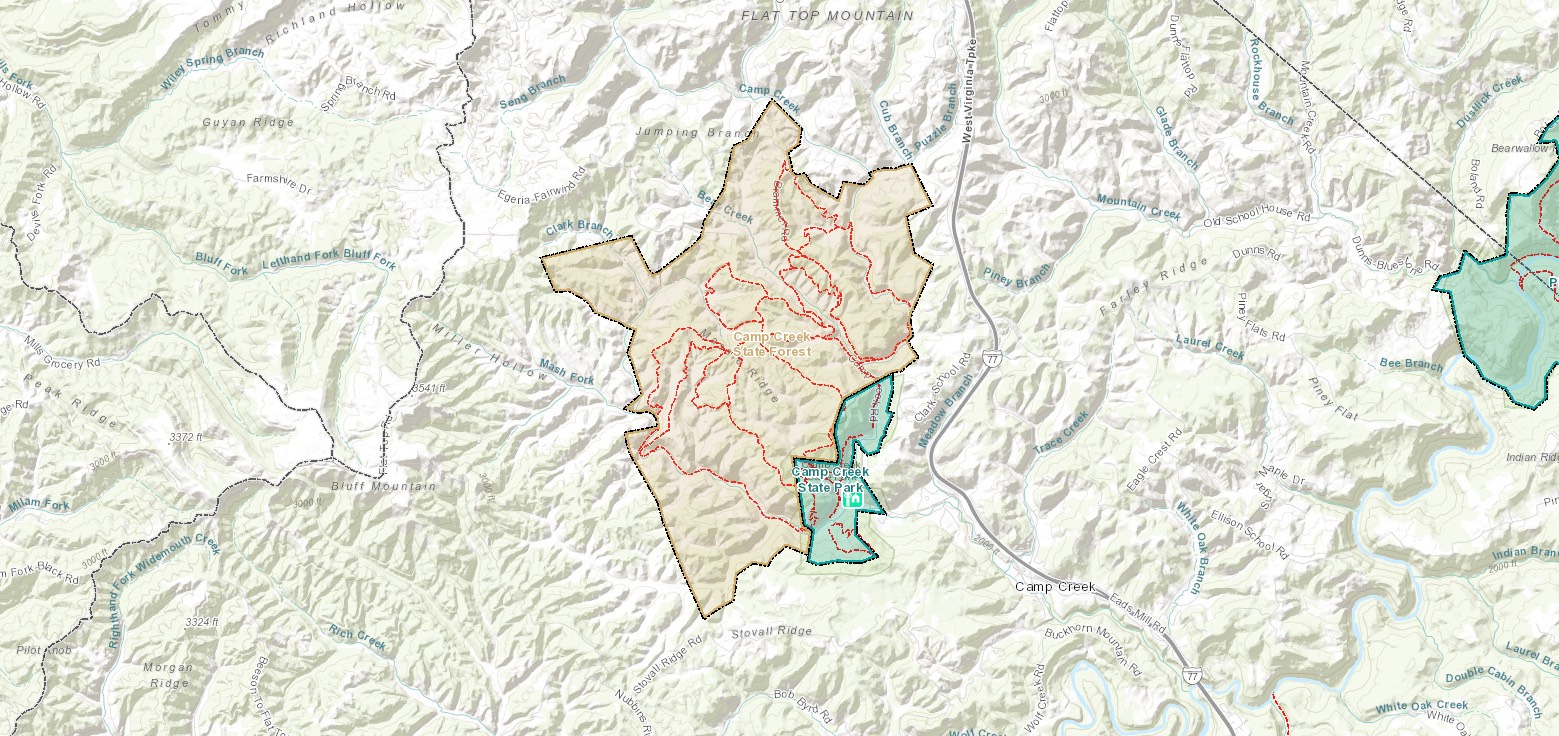
Camp Creek State Park and Forest is known for beautiful waterfalls and great camping. With nearly 6,000 acres of lush forest, 35 miles of trails and seven miles of seasonally stocked trout streams, there is something for every hiker, biker, horseback rider and angler to explore and enjoy. The pristine area was officially named a state park in 1987 after 550 acres were marked off from the Camp Creek State Forest. Located off I-77 in Mercer County, the park is great for family trips and stop-overs during a scenic drive through southern West Virginia.
Accommodations
Select an option below to learn more about the accommodations at this park.Activities
Select an activity below to learn more-
Biking
Biking
With 27 miles of trails open to mountain bikers, it’s no wonder Camp Creek is a crowd pleaser. Plan ahead or pick up a trail map from the park office before you head out!
-
Camping
Camping
Camp Creek State Park and Forest has four campgrounds, all of which include picnic tables, grills and fire rings.
Mash Fork Campground is open year-round, and contains 26 trailer/tent sites, nine with electrical hookups, eight with water and electric hookups, and nine with full hookups. The campground is equipped with Wi-Fi and a heated bathhouse that is open year-round. A campsite reservation application is available here.
Blue Jay Campground, open April through November, includes 12 rustic tent sites.
The Double C Horse and Rider Campground, open April through October, is by reservation only. Two, four or six horse occupancy sites are available. Riders may bring as many horses as their campsite stall accommodates. A campsite reservation application is available here. This campground is for camping with horses. Campers without horses must reserve in our other campgrounds.
The Pack It In – Pack It Out Campground has sites for campers who want to travel away from the mainstream facilities. To reach the campsite, guests must hike or bike more than two miles to the Almost Heaven Road and Trail. Make sure to reserve your spot before arriving. Advance reservations for this remote camping experience is required.
Ranger Outpost Cabin is a primitive camping cabin that is a 3.3 mile hike into the forest. Guests will need to pack in their own bedding, lights, water, etc. Reservations are necessary.
There is no electric or water at this location. The studio-style interior has four bunk style beds and a twin bed in the porch loft. Mattress pads are provided. As a true outpost experience there is no kitchen but there is an outdoor cooking grate. Picnic table is provided. Please keep fires in the supplied fire ring with cooking grate. A port-a-john serves as a restroom facility. Cell service is recognized from all providers. Leave no trace ethics is appreciated. For more detailed information and to make reservations, call the park direct at 304-425-9481 or the call center at 833-wvparks.
-
Fishing
Fishing
Camp Creek offers great fishing opportunities in the park and forest. Pick your favorite spot and bring the whole family for a fun time! But before you head out, make sure you purchase a current West Virginia fishing license, available at www.wvfish.com.
If you’re planning a fishing trip and need overnight accommodations, check in to a cabin or lodge room at nearby Pipestem Resort State Park. But hurry! They book up fast. Make you reservation by clicking Book Now!
Fishing in Camp Creek State Park and Forest
-
Geocaching
Geocaching
Are you ready to hunt for some hidden treasure? Join in on geocaching, the technological scavenger hunt! Camp Creek has 3 cache sites waiting to be found by a smartphone with GPS.
-
Hiking
Hiking
Explore the park on a beautiful hike through nature! Camp Creek State Park & Forest offers 15 trails for a total of 33 miles of scenic hiking. Don’t forget to pick up a map before you head out on your adventure!
-
Horseback Riding
Horseback Riding
See the trails with a little help from a trusty steed. Camp Creek has 30 to 35 miles of trails in the adjacent State Forest available for horseback riding. Equestrian camping is also available.
-
Hunting
Hunting
Hunters are welcome here! Hunting is only allowed in the state forest and valid West Virginia hunting licenses are required which can be purchased online.
Hunting in Camp Creek State Park and Forest
-
Outdoor Adventures
Outdoor Adventures
Hit the courts for some friendly competition and endless fun! Regulation basketball courts, volleyball courts, and badminton courts are available as well as horseshoe areas.
Contact
- Phone: 304-425-9481
- Email: dnrcampcreek@wv.gov
- Address: 2390 Camp Creek Road, Camp Creek, WV 25820
History
Camp Creek State Park became part of the West Virginia parks system in 1987 after 550 acres were marked off from the existing Camp Creek State Forest. The name of Mash Fork, one of the park’s streams, suggests a moonshining past not uncommon in the region.
Trails
Download Park Trail MapAlmost Heaven Road and Trail
Bear Wallow Road and Trail
Blue Jay Ridge Road and Trail
Deer Crossing Road and Trail
Farley Ridge Road and Trail
Hatfield Road and Trail
Horse Bypass Trail
Mash Fork Falls Trail
McCoy Road and Trail
Neely Knob Road and Trail
Piney Ridge Trail
Turkey Loop Road and Trail
Waldrodn Spur Road and Trail
White Oak Road and Trail
Additional Information
Picnicking
Pack a picnic! Picnic areas at Camp Creek can accommodate up to 200 people and are all equipped with tables, fireplaces or grills, restroom facilities and drinking water. Five picnic shelters are available for advance rental. Rentals are based on a first-come, first-served basis and can be rented the first day of each month for the following year.
Nearby Attractions
Tamarack: The Best of West Virginia
Visit one of the best places to get a real taste of West Virginia culture! Located just off Exit 45 near Beckley, Tamarack is a large arts and crafts facility with locally made gifts, food products & more. You can’t miss it with its red-peaked roof!
Crossroads Mall
Care for a bit of shopping? Crossroads Mall, located off Interstate 77 within miles of Beckley, has more than 50 popular stores and restaurants. In addition to shopping and dining, the mall is host to several free community and family events and programs throughout the year.
Beckley Exhibition Coal Mine
At the Beckley Exhibition Coal Mine visitors can tour an underground mine, coal camp and museum. The hands-on exhibitions and underground coal mining tour offer wonderful opportunities for visitors to learn, explore and interact with West Virginia history.
Grandview
Part of the New River Gorge National River, Grandview is a peaceful place to relax and unwind while enjoying outstanding views of southern West Virginia. Located about 10 miles from Beckley, Grandview overlooks the New River, has a visitor center, five hiking trails, ranger-led walks and talks, summer outdoor dramas and picnic areas with playgrounds.
Theatre West Virginia Outdoor Dramas
Theatre West Virginia offers dramas and musicals in an outdoor amphitheater with the dramatic views of the New River Gorge serving as a backdrop. The amphitheater is located near Grandview in Beaver, and is open during the summer.
Twin Falls Resort State Park
Visit Twin Falls for more adventures and memories! Twin Falls Resort State Park is one of West Virginia’s 10 lodge parks offering hiking and mountain biking trails, as well as golfing and tours of a pioneer farm.
Babcock State Park
Babcock State Park, with its famous Glade Creek Grist Mill, is 21 miles southeast of Hawks Nest State Park on U.S. Route 60. It offers a lake for fishing and boating, hiking trails, campgrounds and cabins, and hiking trails.
Hawks Nest State Park
This 276-acre park with a lodge and restaurant is known for its scenic overlooks of the New River Gorge. Visitors can ride the aerial tramway to the bottom of the gorge and ride a jetboat to the base of the New River Gorge Bridge.
Bluestone State Park
Pack your bathing suit for this one! Bluestone State Park is known for its variety of water-oriented activities on Bluestone Lake, West Virginia’s third largest body of water.
Pipestem Resort State Park
The “Year-round Crown Jewel of West Virginia State Parks” boasts numerous recreational activities and stirring mountain views. Golf, horseback riding, bike riding, and an aerial tram are just some of the things you can do!